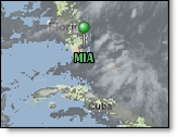
When your cursor is positioned over any one of the Menus they become visible, however after a period of inactivity the Menus will again become transparent. If you move your cursor off of the function menu it will become transparent more quickly.
|
|
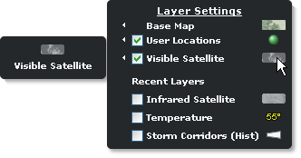
To view preferences hover over the small arrow next to satellite in the Layer Settings menu.
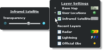
The slider enables visual adjustments to transparency while the layer is loaded.
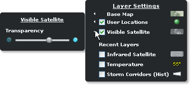
Infrared and visible satellite data are independent layers and cannot be viewed at the same time.
To view the infrared satellite legend, hover over the satellite symbol in the Layer Settings menu.
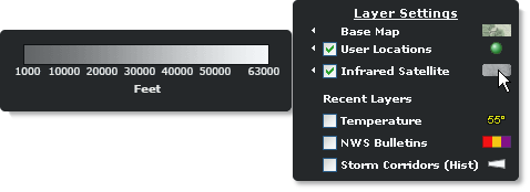
Note: The data will be shown in feet or meters, depending on your interface preferences.
To view the visible satellite legend, hover over the satellite symbol in the Layer Settings menu.
![]()
![]()