RWIS is an optional service available within the Pavement Forecast Transportation, Transportation, Airport Operations and Alberta editions. Contact your sales representative for more details.
|
|
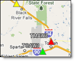
Hourly observed pavement or runway and bridge deck conditions are available from participating RWIS sites to help you provide the most cost-effective road maintenance for your area. RWIS does not provide forecast data.
RWIS pavement sensors provide observations which are available as layers in the Weather Viewer.
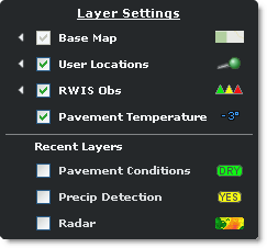
These include:
RWIS Obs
Pavement Temperature
Precipitation Detection
Pavement Conditions
Additional data may be available when hovering over RWIS points.
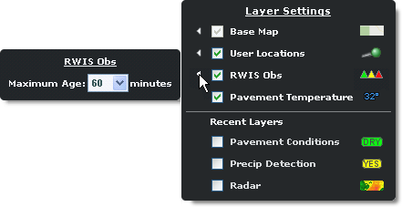
Hover over the Preferences arrow to set the Maximum Age. When data is older than the maximum age the icon will appear red.
Hover over one of the layer symbols in Layer Settings to view the legend.
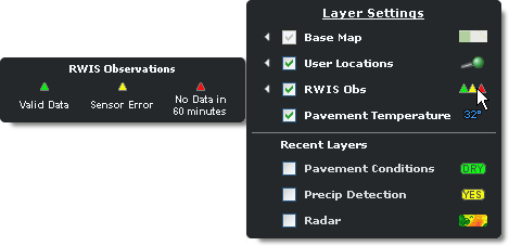
Note: Not all RWIS layers can be selected at the same time. The legend is only available while that layer is selected.
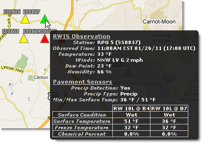
Hover over the location to view additional data from the RWIS site. Data availability will vary between sensors.
![]()
![]()